


Dynamic Solutions has completed numerous studies for the US Army Corps of Engineers on the Mississippi River that serve the purposes of navigation and flood control paired with ecosystem sustainability. We are proud that two of these studies were published in the esteemed collection of Mississippi River Geomorphology and Potamology technical reports.
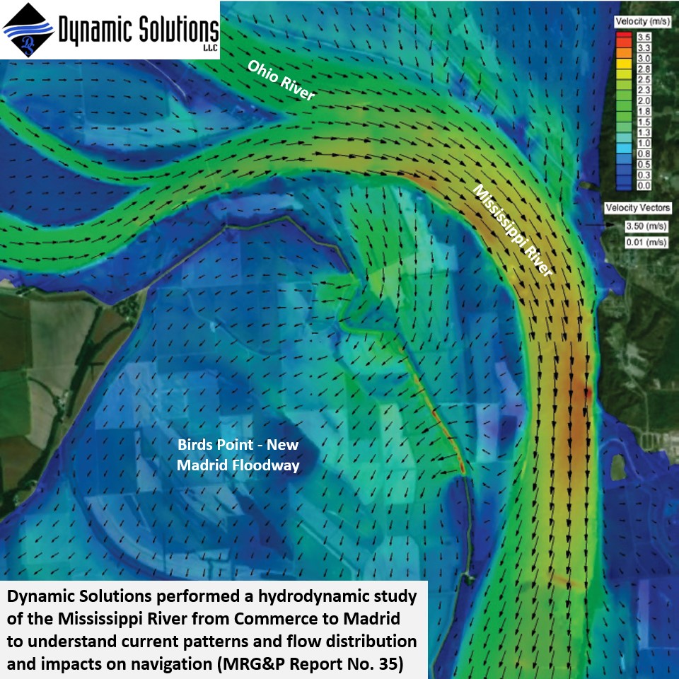
Dynamic Solutions performed a hydrodynamic study of the Mississippi River from Commerce to Madrid to understand current patterns and flow distribution and impacts on navigation (MRG&P Report No. 35).
The restoration at Dogtooth bend aims to be one of the largest floodplain restoration sites on the Mississippi River, providing critical dynamic side-channel habitat. Dynamic Solutions developed hydro-dynamic and sediment transport models of the Mississippi River and Dogtooth Bend Peninsula to simulate structural alternatives to support ecosystem restoration, navigation, and channel stability (MRG&P Report No. 47).
Below the confluence of the Mississippi and Missouri Rivers, very little side-channel habitat exists, which is critical habitat for endangered sturgeon. Dynamic Solutions analyzed and simulated sediment transport dynamics to inform restoration alternatives near Mosenthein Island to create side-channel habitat.
As part of the Navigation and Ecosystem Sustainability Program (NESP), Dynamic Solutions simulated hydrodynamics for design analysis of the Lock and Dam 25 expansion. They also developed a tool for the USACE St. Louis District to estimate scour depths along longitudinal structures in the river.
To support navigation solutions which will maintain key side-channel habitat, at Wolf Island DS performed hydro-geomorphic analyses and sediment transport modeling.
Comments are closed